Snøhetta
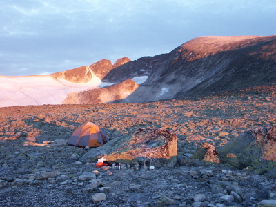
Dovrefjell is a high mountain area that, for millenia, has been crossed by travelers going from the Gudbrandsdalen, a long river valley that stretches north from Oslo, to Trondheim. Now both the E6, Norway's major north-south highway,and the Oslo-Trondheim train line run across Dovrefjell, and on a fair day Snøhetta (Snow Hood) the highest peak in the area, can be seen looming above the barrens to the east. It is 2286 meters (7498 ft), bigger than anything on the US east coast, so when we went to give it a try in September we knew it would be a new high point for both Molly and Zoe. We were able to do it as one-night trip because there is a long dirt road that comes fairly close to the base of the mountain. But it was still 5 kilometers to the steep part, so to make sure we could get within Zoe range we hiked in and camped not far from a shallow lake below the big cirque that is gouged into the side of the mountain.
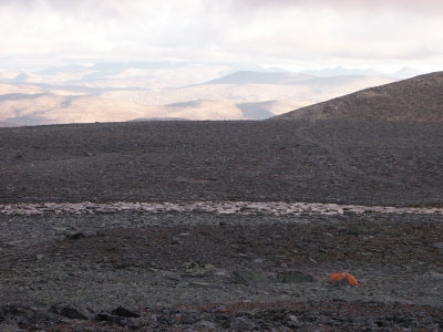
We thought Hardangervidda was barren, but it was a jungle compared to Dovrefjell, where much of the landscape is covered with frost-shattered rock thinly colonized by lichen.
As we approached the mountain we began to wonder if we would find a rock-free place to put up our tent but, as is always true in Norway, we were hardly the first people to have tried camping there, and we found a spot that had already been picked clean of rock. It was a little windy with no prospect of shelter save for two big boulders that offered a little protection for our kitchen. We congratulated ourselves for having bought a first-class mountain tent before having moved here. "Don't worry, it's the kind they take up Everest," we said to the kids, as the wind shook the tent like a dog shaking a squeaky toy.
Dawn. The left-most jagged peak is the west summit, but we went up the main summit, the big dome on the right. Probably a lot of this area remains under snow for a good part of the summer, one reason it is so barren. We don't know what effect, if any, the army's shooting range has had on the vegetation.

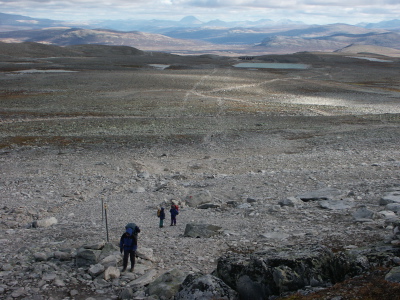
In the morning we assembled for a family photo before heading up the mountain. The summit is over the skyline on the extreme right of the picture. The trail is a relentless scramble over shattered rock (out of sight to the right), never very steep.
As we got higher on the mountain we found that the little bit of snow that had fallen during the previous week had melted and refrozen, making the rocks treacherously slick-- the general purpose Norwegian word for slippery is 'glatt'. But we were still able to pick our way upwards -- here we are quite close to the summit where the mountain rounds off.
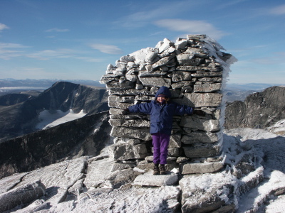
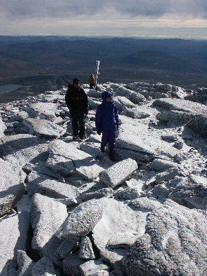
Zoe can now say that she has climbed a bigger mountain at age 7 than Molly did at 9 (Molly and Rick hiked up Mt. Washington a few years ago). In addition to the big cairn, the summit has a small building and with an antenna, some kind of radio or microwave installation. Next to that is a helicopter landing pad -- on a mountain that was nominated for Norway's national mountain! Shades of Mts. Washington, Mansfield, and Whiteface (not to mention Mt. Mitchell in North Carolina). Behind Zoe the mountain does what about 90 percent of Norwegian mountains do: it drops off precipitously about 1,500 feet into a broad cirque with the remnant of the glacier that carved it sitting in the middle. Nancy got vertigo looking at it and wouldn't get too close to the edge.
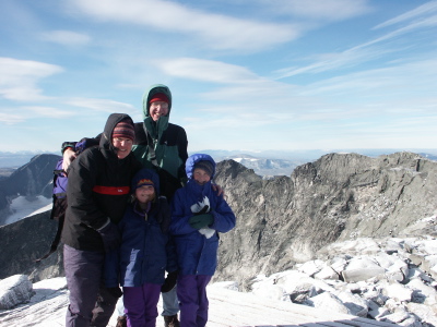
The west peak of the mountain is peeking over Molly's shoulder, but the ridge that connects the two summits divides two cirque headwalls, so it is far too rugged for hiking -- to get to the far summit you have to hike back down and take a different trail.
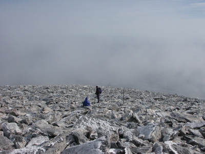
We lucked out with the weather. The summit was in the clouds during the hike in, and the clouds rolled in again as we picked our way down over the icy rocks.
There are some big permanent snowfields on the east side of the mountain-- we hope to return some time on skis.